Tuesday
Aerial photo of site map
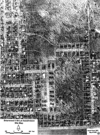
This is the aerial map of the area slated for development. Above the uppermost white line is Cornell's bird sanctuary; below that line is privately owned woodland. Birchwood Drive would extend east and north through the woods and connect with Sapsucker Woods Road. Birchwood Drive North (to be renamed Beechwood) would extend east into a cul-de-sac. Sanctuary Drive would extend west and north into a dead-end (Lucente Way), and also connect with Birchwood North. In all, eighteen acres of woods would be destroyed for forty-seven houses, and this wildlife corridor to the south would be entirely closed off. Wetlands would be preserved, but they would also be severely encroached upon.
![]()