Friday
Briarwood II Master Plan Map
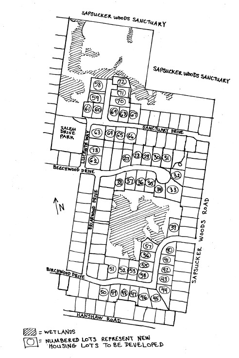
This map gives you a sense of Briarwood II: the size of the development, the closing of the wildlife corridor, the loss of open space, the incursion upon what remains of Sapsucker Woods. (Compare this map with the aerial photo). The circled numbers will be new lots; the shaded areas are wetlands--note how many of the lots approach the very edge of wetlands as delineated. Please also keep in mind that the wetlands will be used as stormwater retention ponds, and thereby will be adversely affected. The numbered lots and new roads total eighteen acres of woodland.
![]()